TUCSON, Ariz. — 2020 can be described in many ways and one description we can apply around here is dry. Our weather pattern turned dry in the spring, then transitioned into a disappointing monsoon and the drought has carried right into fall.
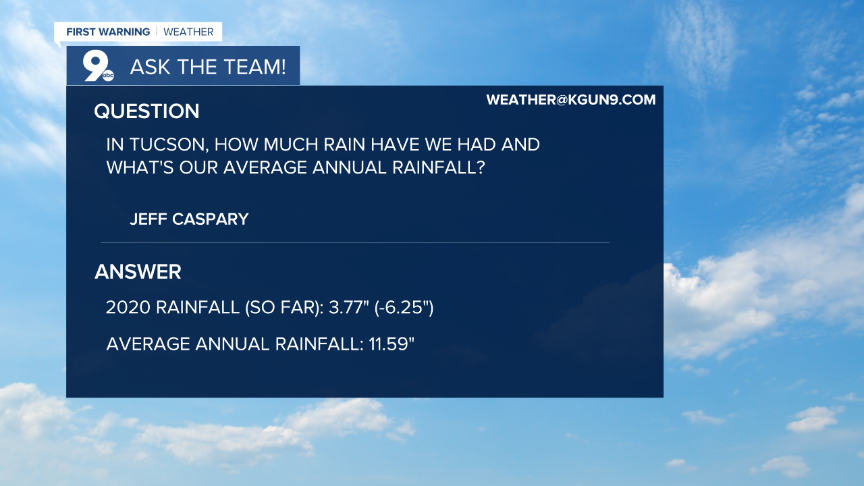
We received a question from viewer Jeff Caspary regarding how much rain Tucson receives per year versus how much we’ve actually received this year. The results are not pretty and we’ll have a hard time catching up as we finish the year.
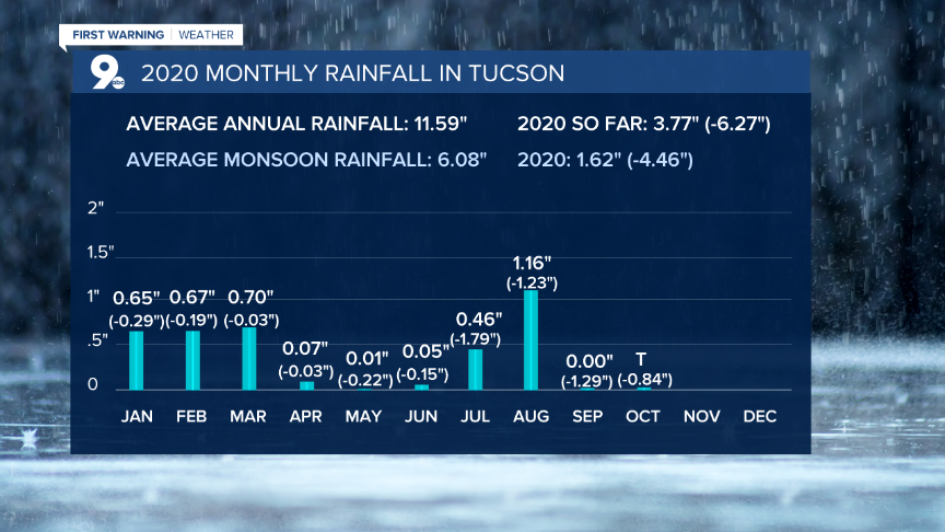
On average, Tucson receives 11.59” of rain at the Tucson International Airport which is where official readings are collected. So far, for 2020, we’ve only received 3.77” of rain. This leaves us over 6” below average up to this date. The deficit is likely to grow as we head into November under a stubborn dry weather pattern.

We entered 2020 with rain totals running over 2” above average from 2019. That didn’t last long as we quickly saw below-average rainfall in January. Little did we know the trend of below-average rainfall would continue all the way through the monsoon and into the fall. In Tucson, we have not seen a single month in 2020 with above average rainfall.
Where we really noticed the dry weather was during monsoon or, as it became known across southern Arizona, the “nonsoon” of 2020. For much of southeastern Arizona, we receive over half of our average annual rainfall during monsoon. When monsoon fails to deliver, it really hurts our rainfall for the entire year.
This year, in Tucson, the monsoon only produced 1.62” of rain and became the 2nd driest monsoon on record. The only other year to record less rainfall during monsoon was in 1924 when only 1.59” of rain fell.

This lack of rain is taking a toll on our drought conditions. All throughout the Southwest, drought is expanding as a persistent area of high pressure blocks moisture from moving over the area. Without any significant moisture, it’s tough to get any significant rainfall and this pattern seems to be one that will stick around through the end of the year.

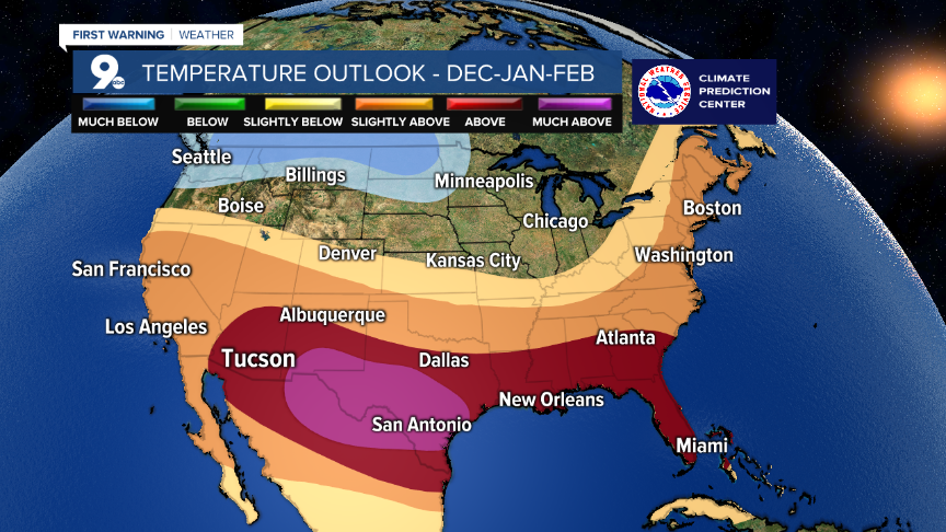
Looking ahead, the winter outlook calls for drier than average conditions combined with warmer than average temperatures. One of the contributing factors is a weak La Nina that is expected to develop.

La Nina conditions occur when sea surface temperatures in the Eastern Pacific Ocean cool below-average temperatures. Typically, this results in drier than average weather for the Southwest which brings warmer temperatures with the exception of the occasional cold front that brings cold, dry air to the region. Even though we’re not expecting a strong La Nina, it could be enough to keep us drier than usual through the winter months.

Hopefully, high pressure will move into a position to allow some moisture in here this winter. Or, we can hope for some low-pressure systems to come in from Baja California and bring some rain. Otherwise, we could be in for a long, dry winter. Let’s just keep hoping for rain to help quench the thirst of our drought-stricken desert!
Cuyler Diggs


